UrbanX
Beschreibung
GIS and Geoinformation Lab at ETH Zurich
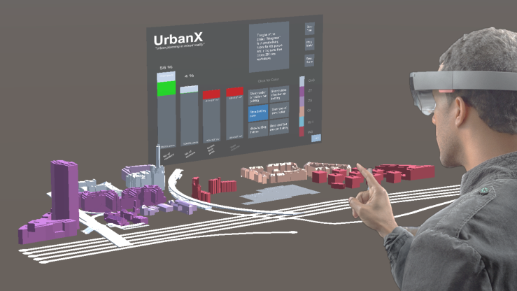
This software was developed as a student project for the GIS and Geoinformation Lab at ETH Zurich. UrbanX is a mixed-reality application for efficient and interactive urban planning. With the use of Esri CityEngine we are able to create a virtual 3D city model and implement functionalities to get information about each building and modify in an intuitive and efficient way.
For more information about the labe visit the following link: www.gis-lab.ethz.ch
Project Goal
The goal of this project was to develop a Hololens application to do urban planning in a mixed reality environment and provide a framework which makes the process more efficient and immersive. The Microsoft Hololens is a recently developed pair of head-mounted mixed reality smartglasses, which lets the user place virtual holograms in the real world and interact with them using specific gestures. The application should display the buildings in the region of interest and let the user access the attributes of each object in an easy and intuitive way. Editing functionalities should allow the user to freely make changes to the model.
On YouTube Have a look at the illustrative Video on YouTube: GIS Lab 2018 - UrbanX
Author
Hasret Gümgümcü
Webseite
https://urbanxgis.wordpress.com/Tags
Datensätze
Bitte versuch es mit einer anderen Suche.