Suchergebnis: 7 Treffer
Zurich hand-drawn
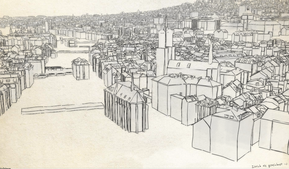
This website visualises the 3D City Model of Zurich with computer generated sketches that look as if it was hand drawn. Brilliant work by the GIS Competence Center of the City of...
Zürich MapView
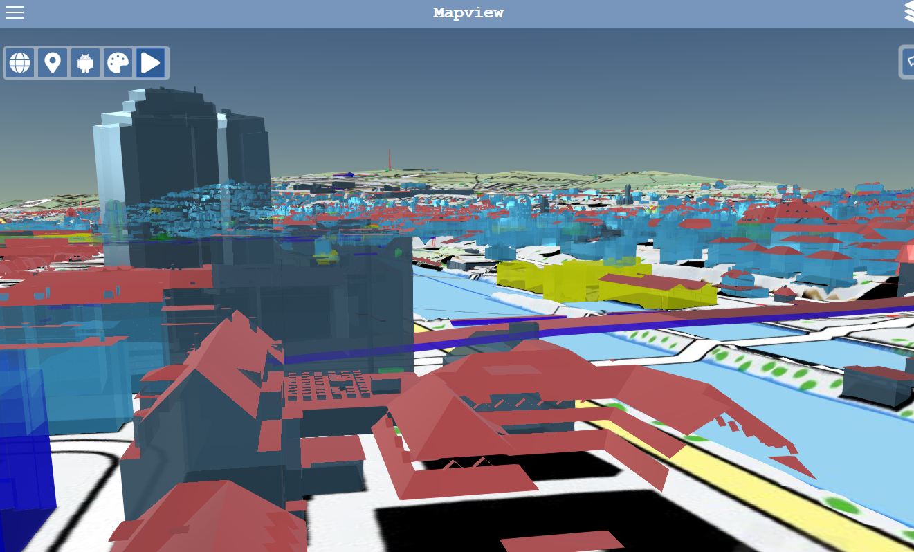
Bei der Anwendung handelt es sich um eine Kombination aus einem üblichen 2D-Kartenviewer und einem 3D-Viewer im Browser. Beim 3D-Viewer können verschiedene Hintergrundkarten...
UrbanX
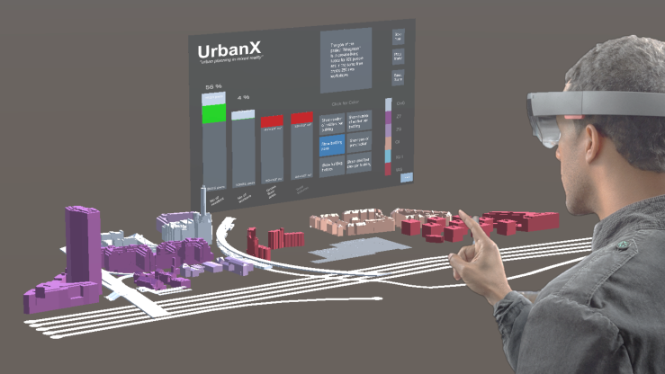
GIS and Geoinformation Lab at ETH Zurich This software was developed as a student project for the GIS and Geoinformation Lab at ETH Zurich. UrbanX is a mixed-reality...
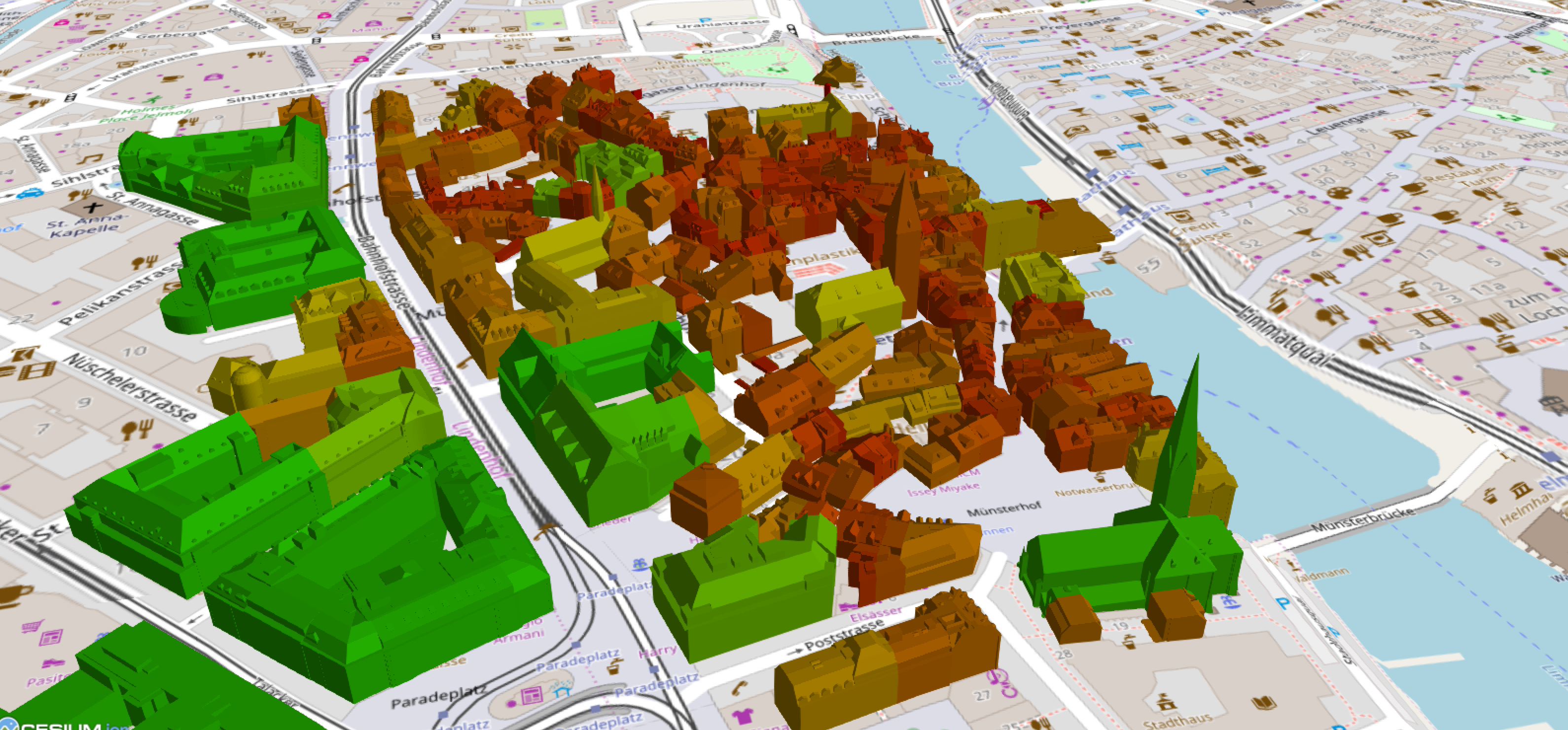
Zurich 3D Buildings
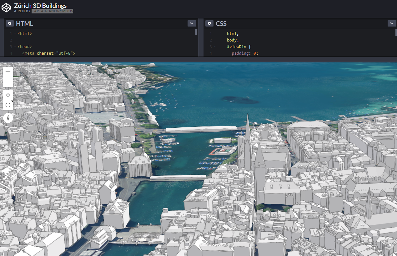
Play around with Vasiles CodePen.io playground using the 3D City Model from Zurich.
Old Photos in Zurich
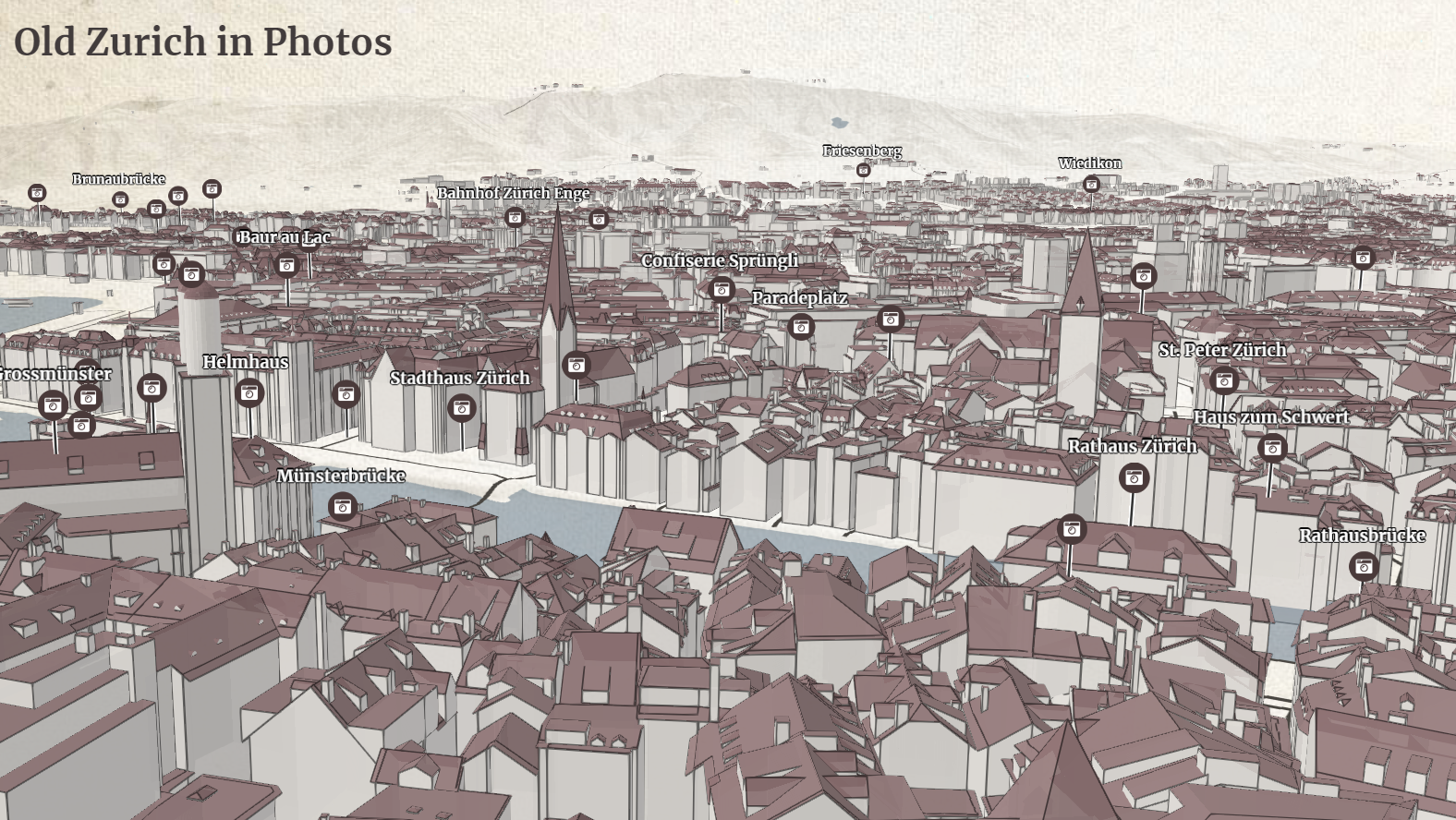
Explore images of old Zurich on a 3D map of the city of Zurich. The georeferenced, digitized images are part of ETH Library and they stem from the E-Pics platform. The map uses 3d...
«CityGML-to-3DTiles»-Converter
There's a NodeJS script using citygml-to-3dtiles to convert the CityGML data to 3D-Tiles. A Webpack configuration then creates a static website loading the 3D Tiles in Cesium on...
3D Zürich EqualStreetNames Application
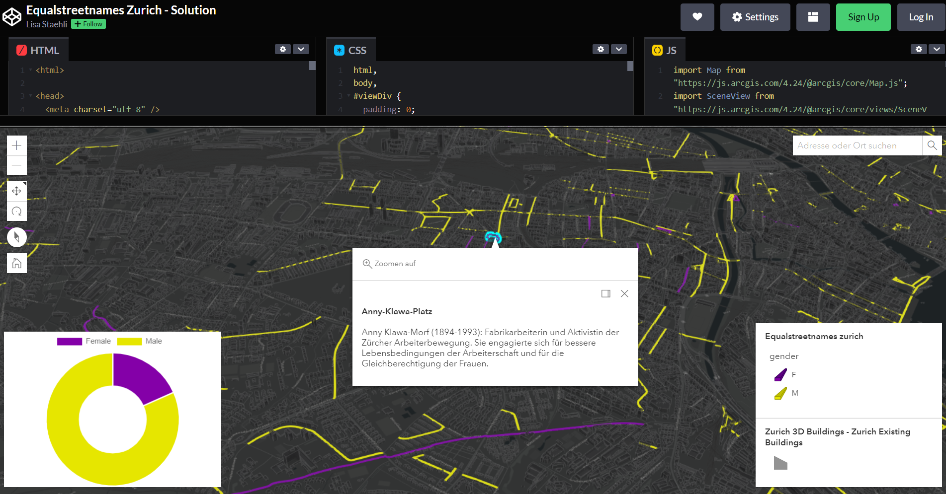
Diese Anwendung wurde im Rahmen des ersten «Women @ Esri hands-on coding workshop» erstellt und erklärt, wie mit der ArcGIS API for JavaScript eine interaktive 3D Anwendung mit...